Reality capture, digital reconstruction, inspection, and construction intelligence services
Capture what is actually built using high-accuracy reality capture for verification and comparison.
Learn MoreConvert existing structures into intelligent digital models for retrofit and upgrade planning.
Learn MoreDerive models, drawings, or quantities from the same scan data based on project intent.
Learn MoreCreate lifelike digital records for conservation, restoration, and long-term preservation.
Learn MoreInspect towers, plants, and buildings using measurable, image-driven inspection workflows.
Learn MoreConstruction progress tracking and high-quality visual documentation.
Learn More“Capture what exists, to know what had been and will be.”
An as-built survey bridges the gap between architectural intent and constructed reality. It may be performed during construction, post-completion, or long after delivery to assess deformation, alignment, and execution accuracy.
While conventional surveys remain valid, VALASAI recommends Terrestrial Laser Scanning for projects requiring completeness and precision. Laser scans supported by redundantly adjusted site control capture full geometry as a single coherent dataset.
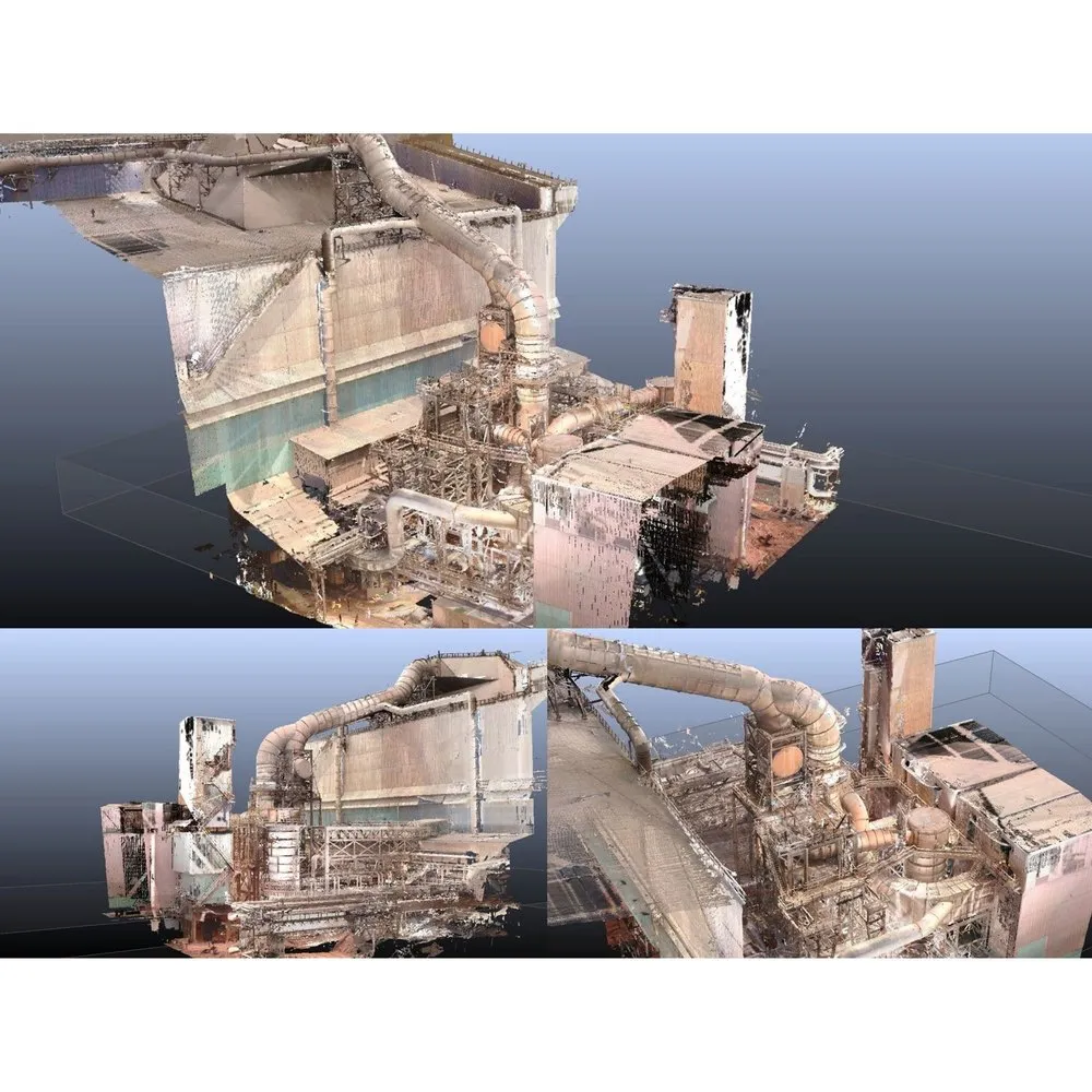
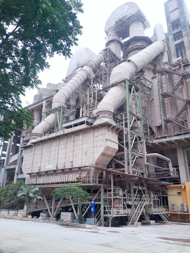
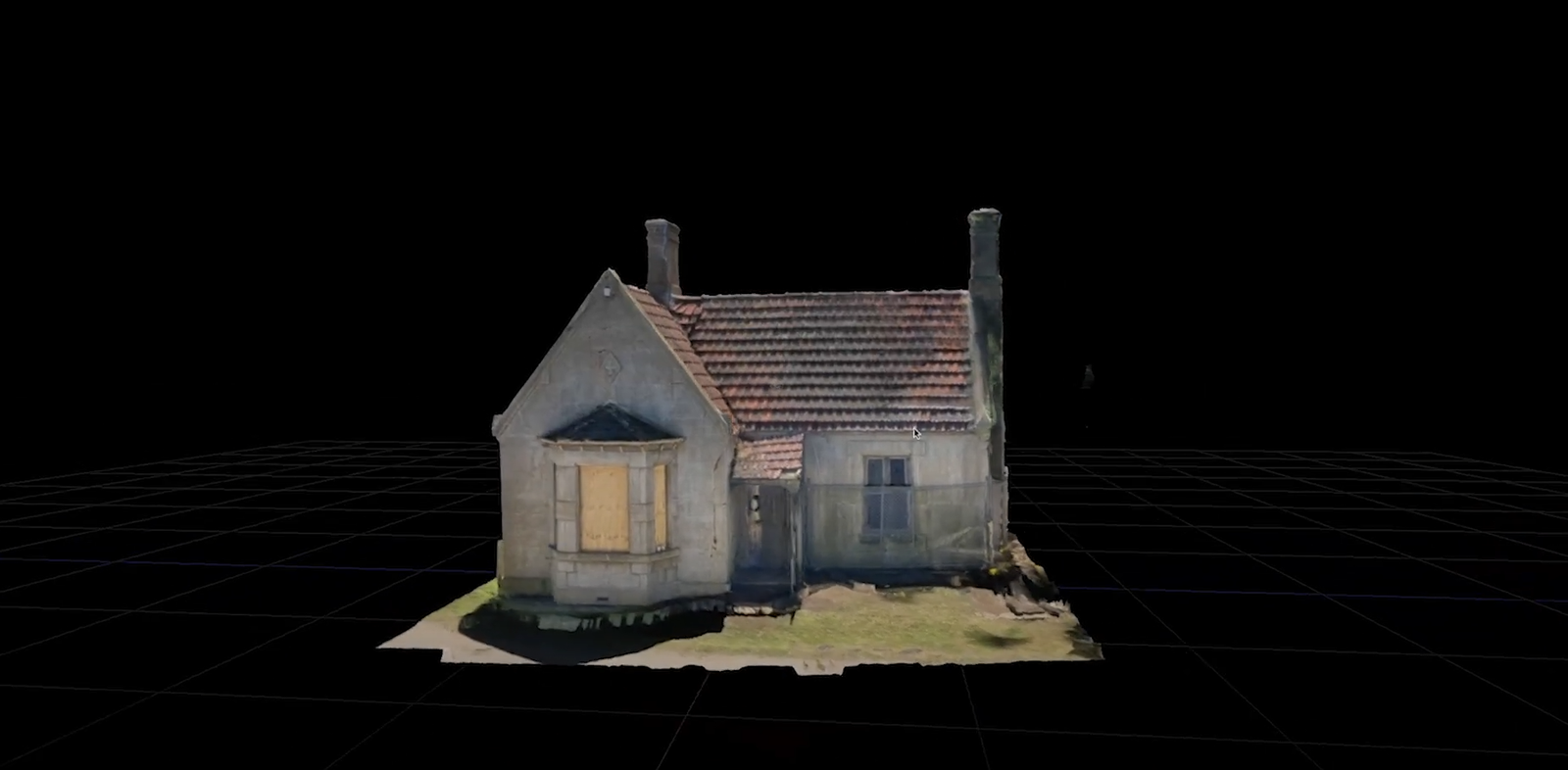
Scan to Cloud As-Built: As-Built Analysis of an Air-Quenching Cooler Boiler System at a Cement Factory in Ariyalur
“When reality captured is not enough, reality must be rebuilt into usables.”
Raw scan data remains observational unless reconstructed into intelligent digital models. Reverse engineering converts captured reality into functional BIM representations.
VALASAI develops true as-built BIM models reflecting existing conditions, tolerances, and system relationships—supporting retrofit, expansion, and system coordination.
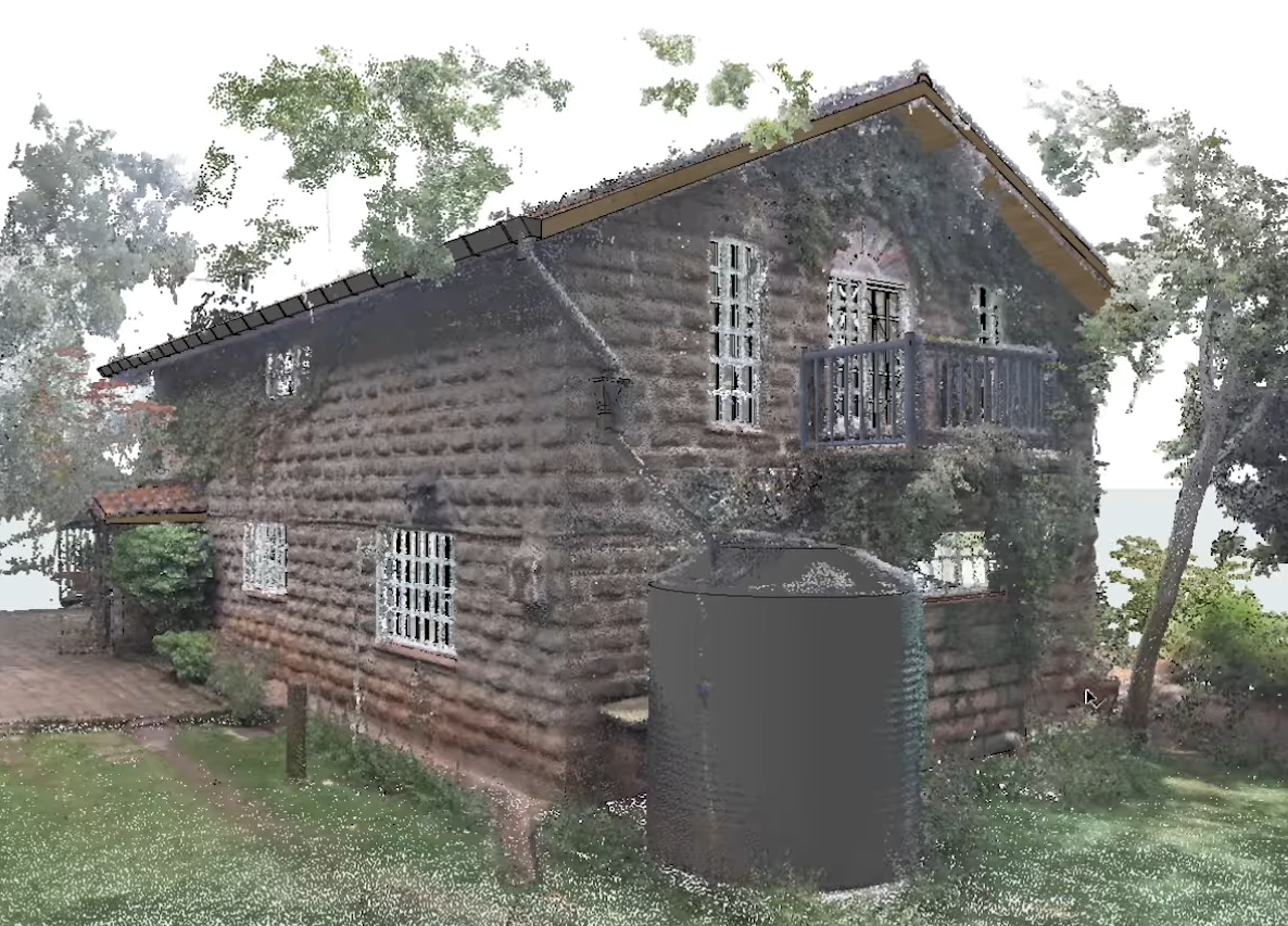
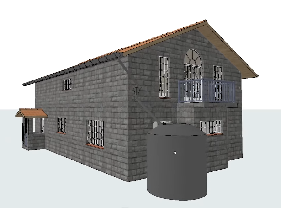
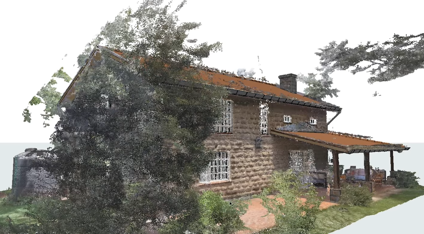
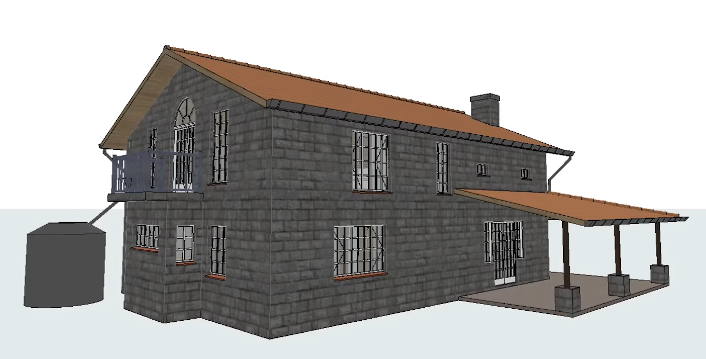
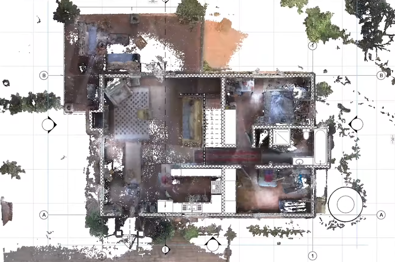
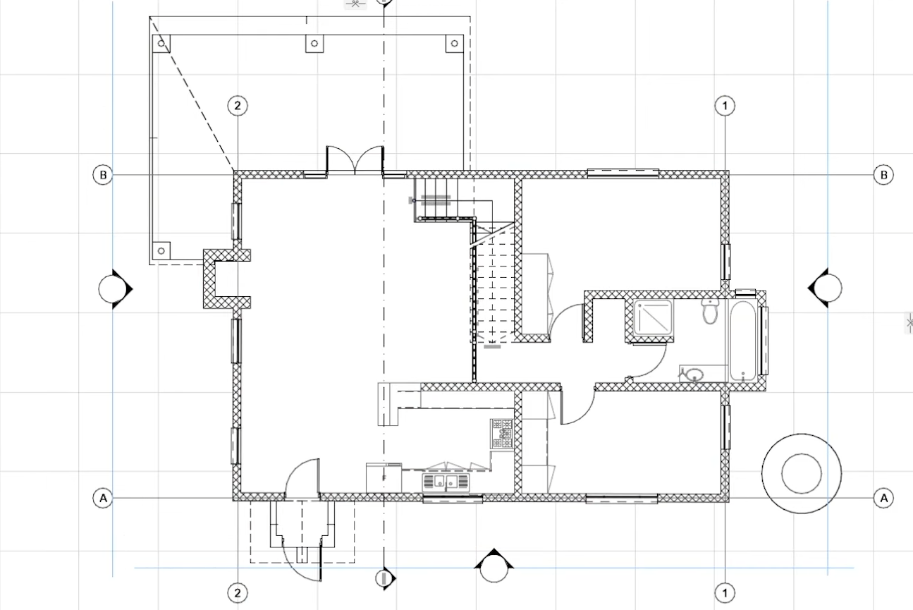
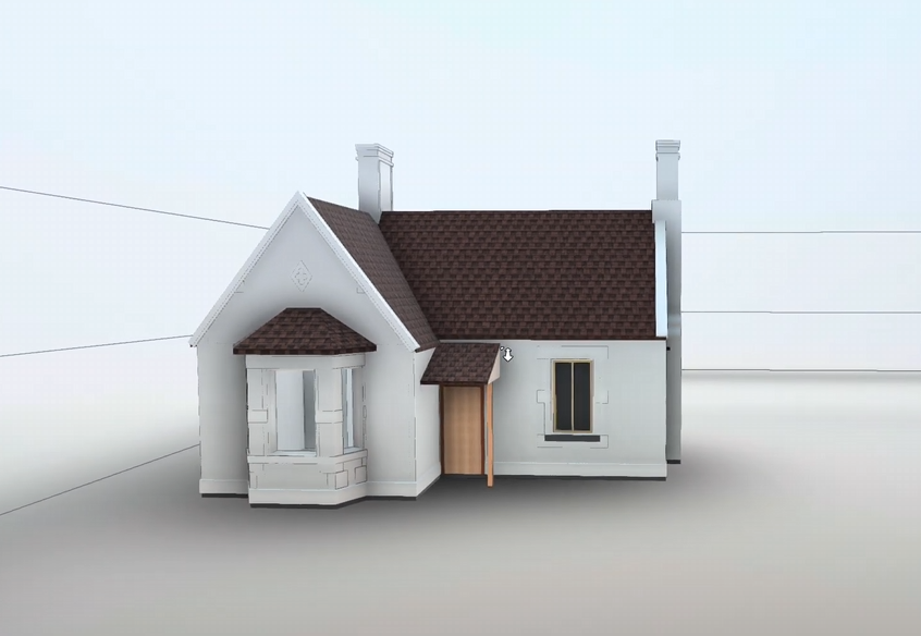
Scan-to-Model: Handheld SLAM Scan-to-Model/Plan of a Building at DakshinaChitra, Chennai
Reality capture of existing structures, systems, and objects can be translated into different digital outcomes depending on the purpose.
The same scan data, when interpreted with the right intent, can become a visual model, a set of measured drawings, or a quantified cost reference — each serving a distinct role in design, documentation, and decision-making.
| Scan-to-Model | Scan-to-Plan | Scan-to-Quantity Takeoff |
|---|---|---|
| Converted into a 3D conceptual/abstract model | Converted into 2D plans, sections, and elevations | Converted into item-wise material quantities |
| Emphasis on visualisation, spatial understanding, and interfaces | Emphasis on measured documentation and records | Emphasis on cost, billing, and reconciliation |
| Represents what is physically present, not design intent | Represents as-built drawings, not proposed layouts | Represents actual executed quantities, not estimates |
| Used by architects, planners, retrofit designers | Used by consultants, approval authorities, facility teams | Used by quantity surveyors, contractors, project managers |
| Supports concept studies, renovation, integration | Supports documentation, compliance, reference | Supports BOQ preparation, cost control, verification |
| Software & Deliverables: 3D modelling platforms such as Autodesk Revit and SketchUp; delivered as 3D models, neutral exchange formats, and visual views | Software & Deliverables: Drafting and point-cloud tools such as AutoCAD and Autodesk ReCap; delivered as DWG/PDF plans, sections, elevations | Software & Deliverables: Measurement and tabulation using Microsoft Excel and point-cloud analysis tools; delivered as BOQ sheets, quantity tables, and abstracts |
“Assess structural condition with AS-IS 3D reality modelling.”
Heritage assets require documentation that captures more than drawings or dimensions. Traditional scanning and 3D models describe form and function, but conservation decisions depend on understanding the existing condition of a structure.
AS-IS reality modelling preserves the visible truth of a building, including surface ageing, material distress, and architectural character — enabling informed conservation and restoration planning.
Valasai follows a photogrammetry-driven approach using high-resolution DSLR imagery for interiors and drone imagery for exteriors. Laser scanning is integrated where additional spatial control is required, producing textured 3D reality models that preserve colour, detail, and spatial accuracy.
Heritage: Restoration of a British-Period Building at Egmore, Chennai
“Dilapidation and defect identification through measurable reality capture.”
Our inspection services follow a photogrammetry-driven workflow designed to provide clarity with minimal disruption. High-overlap imagery captured using drones or high-resolution cameras creates a spatially accurate 3D reference model.
Using inspection platforms such as Pix4Dinspect, areas of interest are reviewed through original source imagery. Defects are documented with precise annotations, measurements, and exact location references.
| Tower Inspection | Industrial Site Inspection | Roof & Confined Space Inspection |
|---|---|---|
|
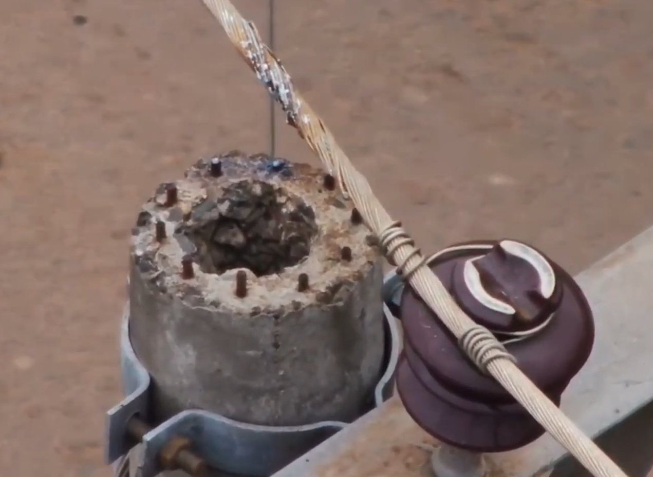
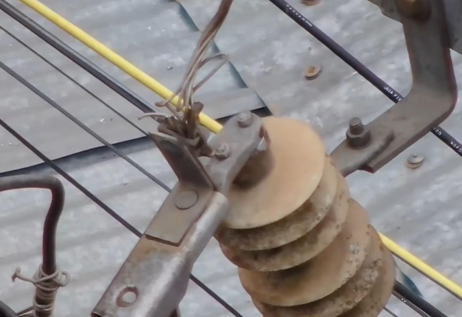
What is inspected: Transmission towers, communication masts, elevated steel structures, joints, fasteners, and attachments. Why it is necessary: These assets operate under constant environmental stress such as wind, corrosion, and vibration, where early defects can escalate into service or safety failures. Who benefits: Utility providers, telecom operators, and infrastructure owners seeking safe, repeatable inspection without shutdowns or physical climbing. |
What is inspected: Buildings, pipe racks, equipment supports, interfaces, and operational zones across large industrial facilities. Why it is necessary: Industrial environments evolve continuously, and hidden degradation or access conflicts can impact safety, maintenance, and operations if left undocumented. Who benefits: Plant owners, operators, engineers, and safety teams who need a clear view of asset condition without interrupting production. |
What is inspected: Roofs, canopies, tanks, service corridors, internal voids, and other hard-to-reach or unsafe areas. Why it is necessary: These zones often conceal early signs of leakage, surface distress, or material failure that are difficult to detect through manual access. Who benefits: Building owners and facility managers aiming to reduce risk while improving inspection coverage and accuracy. |
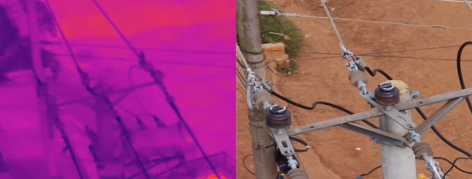
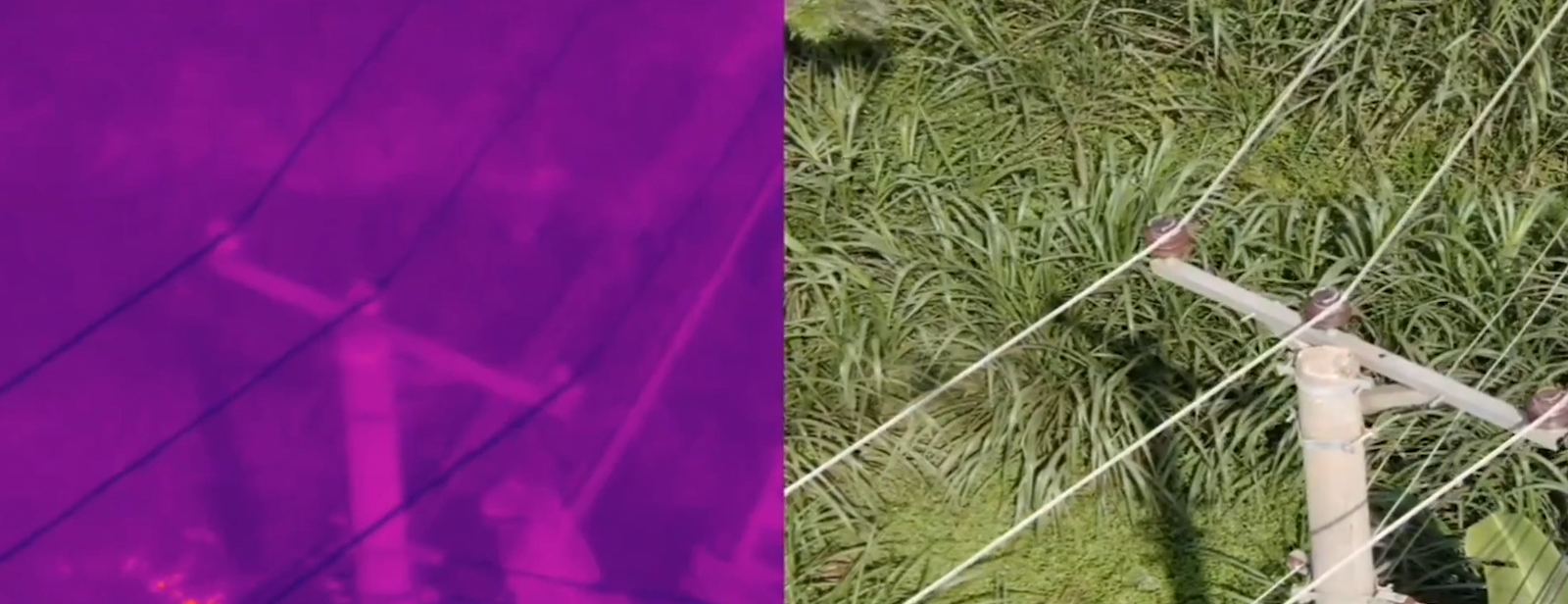
Inspection: Proposed SIPCOT Site at Vallam, Sriperumbudur
“Visual documentation that tracks progress and communicates value.”
During construction, visual clarity becomes as important as technical reporting. Valasai captures periodic high-resolution photographs, aerial videos, and panoramic views from consistent viewpoints, enabling clear comparison of project progress over time.
This creates a visual progress record supporting inspection, coordination, and stakeholder communication while providing confidence in site development.
Upon completion, the focus shifts to presentation. Carefully composed photographs, cinematic videos, and aerial visuals are produced to showcase the finished asset for marketing, promotion, and stakeholder engagement.
Talk to our engineering and construction specialists
Connect With Us