Surveying, reality capture, and geospatial instrumentation for applied practice
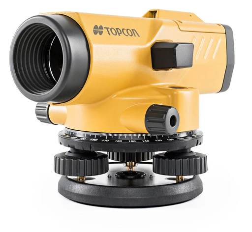
Establish and transfer height with high repeatability for reliable elevation control across your site.
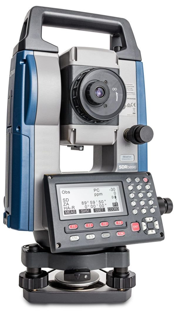
Learn MorePrecise point positioning and layout for dimensional control and construction setting-out.
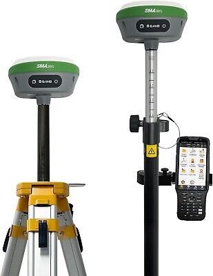
Learn MorePosition surveys within a global coordinate framework and extend control over large areas.
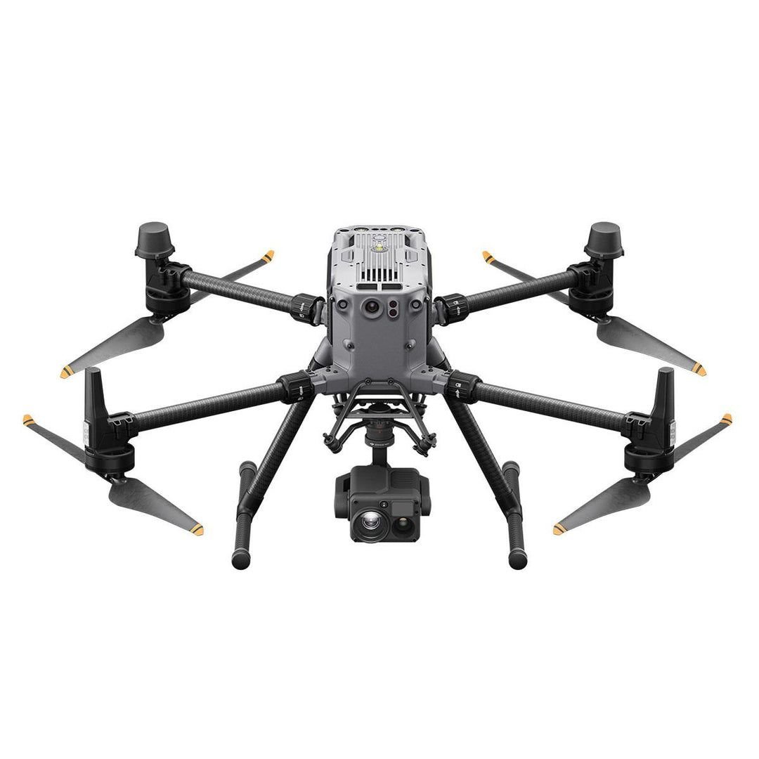
Learn MoreAerial perspective and visual access to structures where ground access is limited or unsafe.
Learn MoreTransform photographs into accurate 3D models with geometry, surface detail, and visual context.
Learn MoreHigh-density point cloud capture for complete as-built documentation and digital archival.
Learn MoreRapid mobile capture of interiors and complex spaces where speed and continuity matter.
Learn MoreAirborne terrain mapping that penetrates vegetation for accurate ground surface capture.
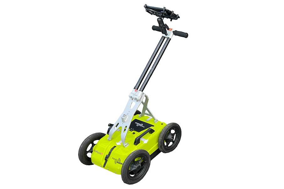
Learn MoreNon-invasive subsurface investigation to detect utilities, voids, and buried features safely.
Learn MoreUsed where reliable elevation control is required, the level instrument establishes and transfers height with high repeatability across a site.
Level instruments form the foundation of vertical control in construction and infrastructure projects. Whether establishing permanent benchmarks or transferring heights for floor level verification, these instruments deliver consistent, traceable elevation data that supports every phase of site development and construction.
The total station is deployed for precise point positioning and layout where line-of-sight measurement and dimensional control are critical.
Combining electronic distance measurement with angular precision, total stations deliver comprehensive spatial data for boundary definition, topographic mapping, and construction setting-out. These instruments establish the geometric framework that coordinates design intent with physical execution on site.
GNSS is used to position surveys within an absolute global coordinate framework and to extend control efficiently over large or open areas.
Satellite-based positioning systems eliminate the need for inter-visible control points and enable rapid establishment of primary survey networks. GNSS provides the coordinate foundation that integrates site surveys with regional mapping systems and ensures long-term positional consistency across projects.
Drone inspection is adopted when ground access is limited or unsafe and a clear visual understanding of site conditions is required.
Unmanned aerial systems provide rapid visual access to roofs, facades, towers, and infrastructure that would otherwise require scaffolding, rope access, or specialized equipment. High-resolution imagery and video documentation enable condition assessment, progress monitoring, and stakeholder communication from perspectives that reveal issues invisible from ground level.
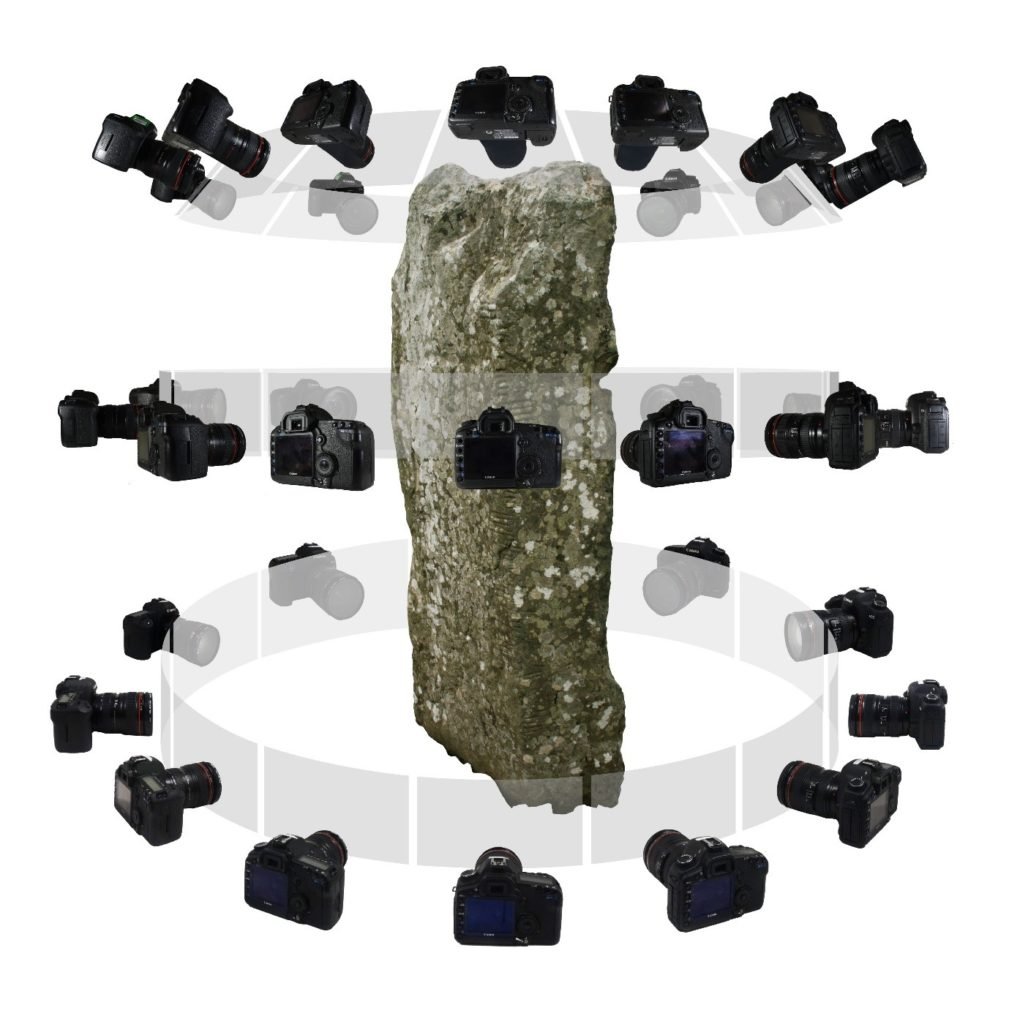
Photogrammetry is applied where three-dimensional geometry, surface detail, and visual context must be captured together from images.
By processing overlapping photographs, photogrammetric software reconstructs accurate 3D models complete with photorealistic textures. This technique transforms standard imagery into measurable spatial data, providing orthophotos, elevation models, and textured meshes that support design, documentation, and heritage preservation without specialized scanning equipment.
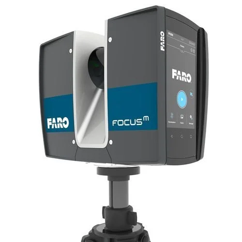
A terrestrial laser scanner is used when complete, high-density capture of existing conditions is required with minimal interpretation on site.
Terrestrial scanners emit millions of laser pulses to create detailed point clouds that record every visible surface with millimetre-level precision. This complete digital record eliminates the need for selective measurement and supports comprehensive as-built modelling, deformation analysis, and retrofit planning with data that can be revisited and remeasured long after fieldwork concludes.
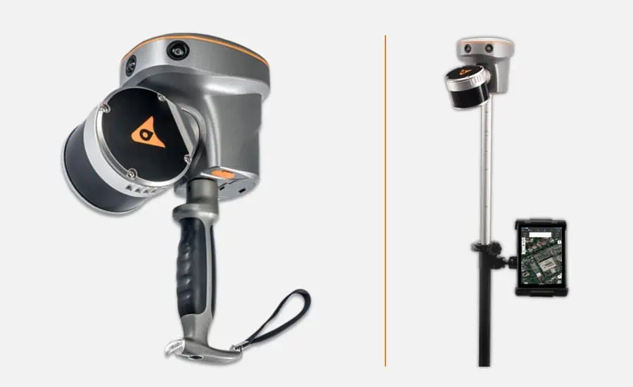
Handheld SLAM scanners are selected for rapid capture of interiors and complex spaces where speed and continuity of data matter more than static precision.
SLAM (Simultaneous Localization and Mapping) technology enables continuous scanning while walking through a building, capturing entire floor plans, corridors, and multi-story spaces in minutes rather than hours. This mobility makes handheld scanners ideal for preliminary documentation, feasibility studies, and projects where access time is limited.
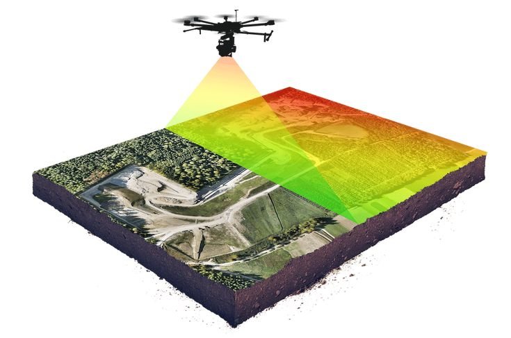
UAV laser scanning is employed to map terrain and corridors efficiently, especially where vegetation or access constraints limit conventional surveys.
Drone-mounted LiDAR systems penetrate vegetation canopy to capture ground surface beneath trees and dense foliage, generating accurate digital terrain models over large areas rapidly. This capability makes UAV LiDAR essential for infrastructure corridor planning, flood modeling, and earthwork projects where traditional survey methods would be time-prohibitive or physically impractical.
GPR is a trenchless technique, used to understand what lies beneath the surface before excavation, cutting, or structural intervention is undertaken.
Ground penetrating radar transmits electromagnetic pulses into the ground and records reflections from buried objects, utilities, voids, and layer boundaries. This non-invasive investigation method reveals subsurface conditions without excavation, enabling safe construction planning, utility mapping, and condition assessment of pavements, slabs, and foundations before any invasive work begins.
Connect with our instrumentation and geospatial specialists
Connect With Us