Comprehensive surveying and planning solutions for land development projects
Understand what lies beneath your site through soil strength testing and groundwater analysis, forming the foundation for safe and informed design decisions.
Learn MoreAnalyse surface elevations, drainage paths, and watershed behaviour to plan developments that work with natural water flow rather than against it.
Learn MoreCapture existing features, access, utilities, terrain, and environmental conditions to establish a clear and reliable site baseline.
Learn MoreDefine property limits with legal certainty using cadastral methods, ensuring boundaries are clear, defensible, and approval-ready.
Learn MoreConvert raw land into a DTCP-compliant layout by planning plots, roads, utilities, and open spaces as per Tamil Nadu Combined Development and Building Rules 2019.
Learn MoreQuantify earthwork requirements by analysing existing and proposed ground levels, enabling accurate planning of excavation and material reuse.
Learn MoreEstablish permanent benchmarks and control points that guide construction accuracy from initial setting-out to final as-built verification.
Learn MoreLand development depends as much on what lies beneath the surface as on what is planned above it. Soil behaviour and groundwater conditions directly influence foundation safety, construction feasibility, and long-term performance.
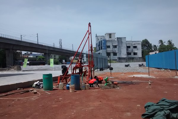
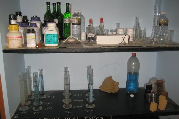
At VALASEI, subsurface conditions are evaluated through borehole drilling with Standard Penetration Tests (SPT) to establish soil stratification and load-bearing capacity. Groundwater assessment is carried out using Electrical Resistivity Tomography (ERT) to identify water-bearing zones, locate viable aquifers for wells or boreholes, and approximate seasonal high groundwater levels.
These investigations allow your construction to support informed foundation design, earthwork planning, groundwater strategy, and constructability decisions.
For proposed Phase I Coimbatore metro rail project at Vellalore
Understanding how a land parcel sheds, concentrates, and conveys water is essential before any development modifies the existing surface. Elevation, land cover type, and soil perviousness together govern runoff direction, flow concentration, and drainage volume.
At VALASEI, surface investigation is carried out using GNSS and/or Drone Surveys with Optical/LiDAR Payloads, generating accurate bare-earth terrain models (DTM) and surface models including built and natural features (DSM). These datasets, along with contours and spot levels, capture ridges, valleys, slope breaks, and surface continuity, forming the physical basis for watershed delineation predicting subbasins, sinks, and minor and major streamlines.
Using meteorological data and annual rainfall records, we convert the expected precipitation response into measurable surface flow result, through curve number estimation and hydrograph modelling, arriving at realistic discharge rates. Field-surveyed surfaces are processed using tools such as QGIS and HEC-HMS to visualize and simulate basin area, direction of flow, rainwater outflow, and discharge behaviour—delivered as clear, decision-ready outputs.
DTM, DSM, Contour & Spot level at preferred interval, Hydrographic model.
These outcomes allow development to manage surface water responsibly, prevent flooding, and prevent man-made flooding caused by disturbed natural flow patterns.
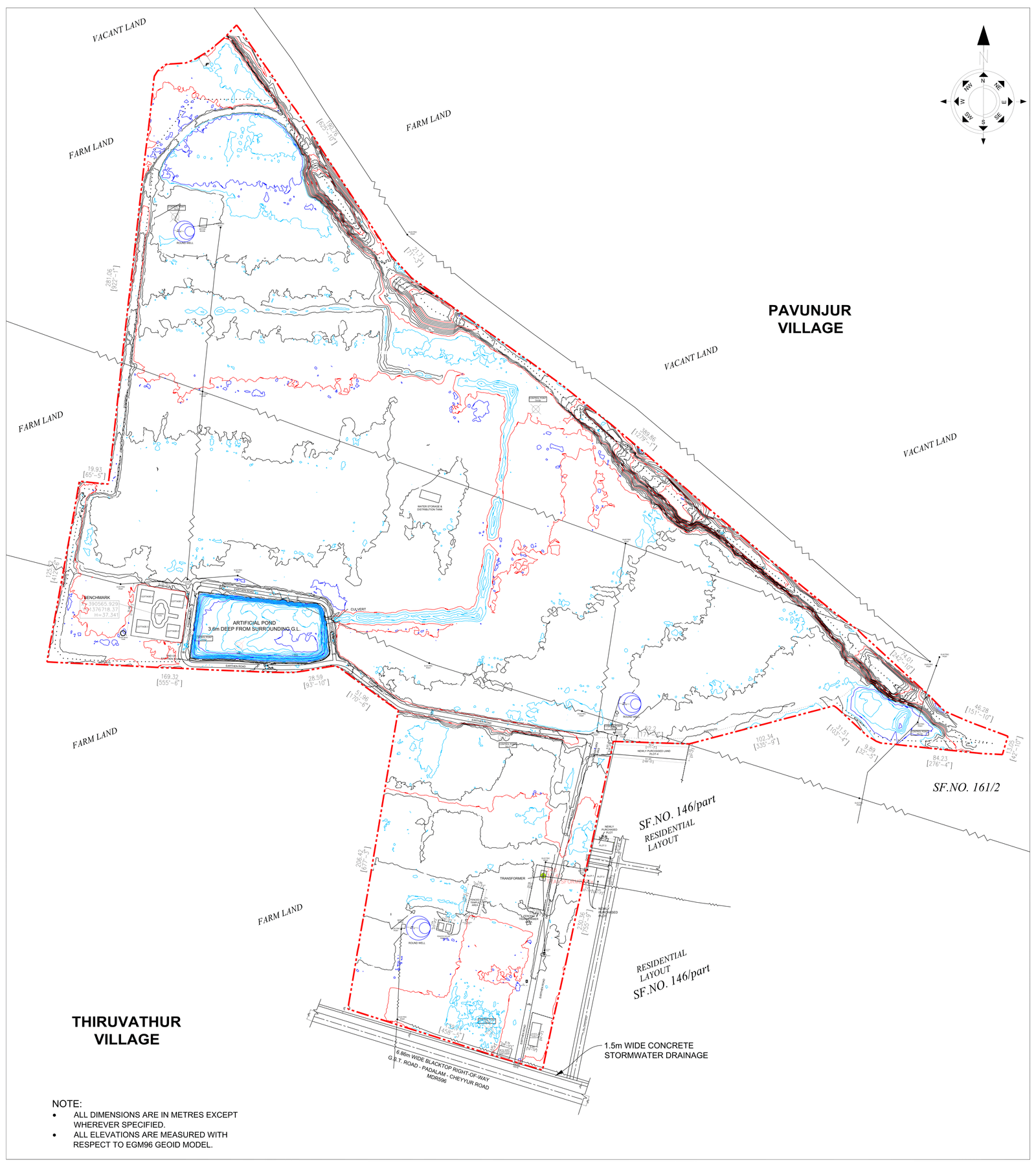
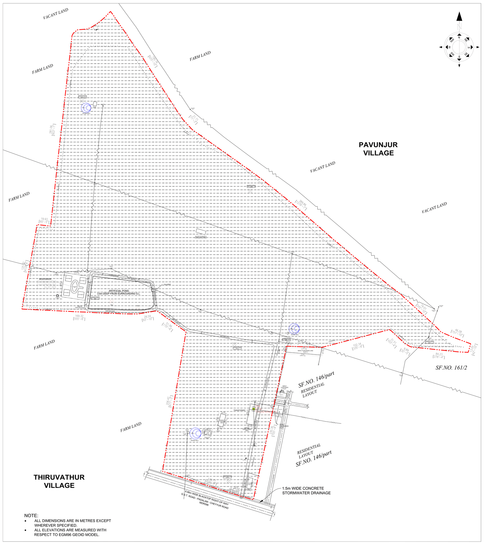
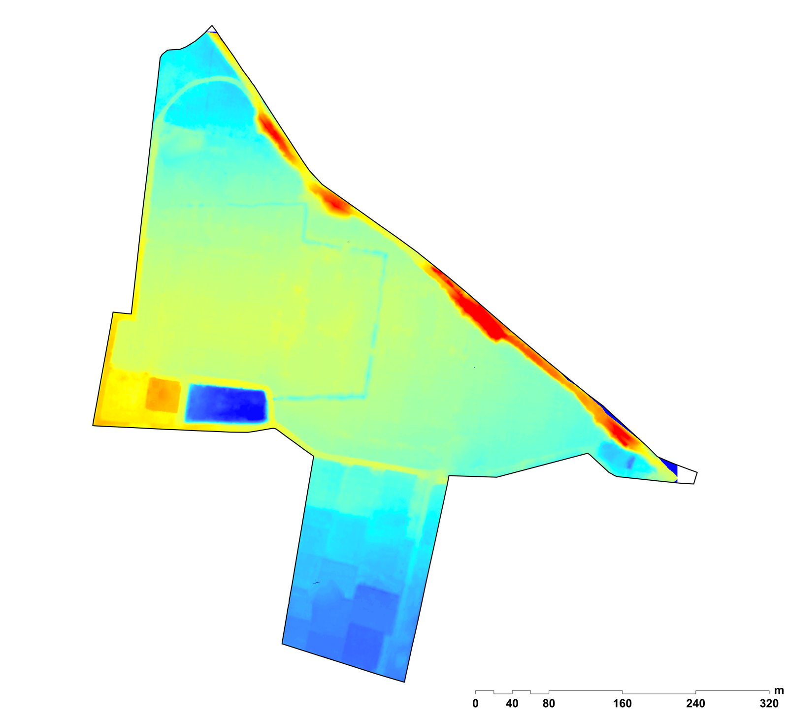
Identification of water logging area for a farmland at Cheyyur of project area 49 acres
Our topographical survey establishes a precise record of existing site conditions, documenting existing buildings, compound walls, fencing, pavements, kerbs, culverts, crossings, along with access lanes and access points. Key surface infrastructure such as electrical features and visible drainage networks are captured using Total Station, GNSS / DGPS, and Drone surveys, and the resulting access data is analysed to generate a traffic and access report supporting right-of-way and entry-exit planning.
To address utilities and services that are not visible on the surface, Ground Penetration Radar (GPR) is employed for subsurface feature identification, enabling the detection of buried utilities and services without excavation.
In parallel, environmental documentation is carried out using Drones and DSLR cameras for photography and videography, recording existing vegetation, land cover type, soil permeability, and natural features such as water bodies and surface channels. These observations are compiled into an environmental assessment report, providing clients with a clear understanding of the site's ecological and surface context.
By integrating measured survey data, subsurface intelligence, and structured visual documentation, VALASEI delivers a complete existing-features understanding, ensuring that planning and development decisions begin with clarity—while boundary fixation is addressed separately under a dedicated boundary survey activity.
Topographical Study & Feature Identification, Traffic and Access Report, Environmental Assessment Report
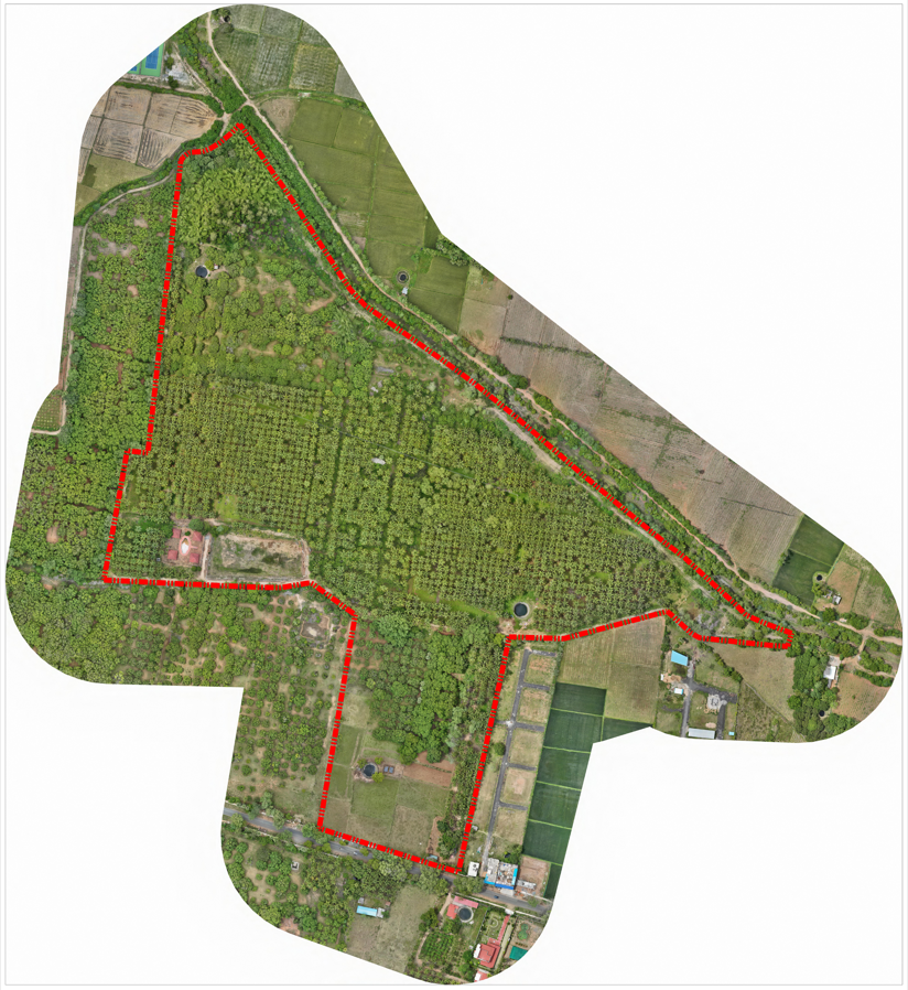
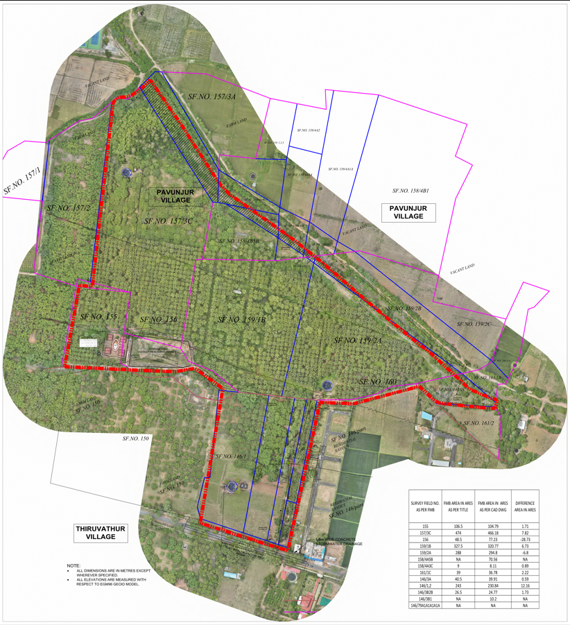
Topographical feature extraction for a farmland at Cheyyur of project area 49 acres
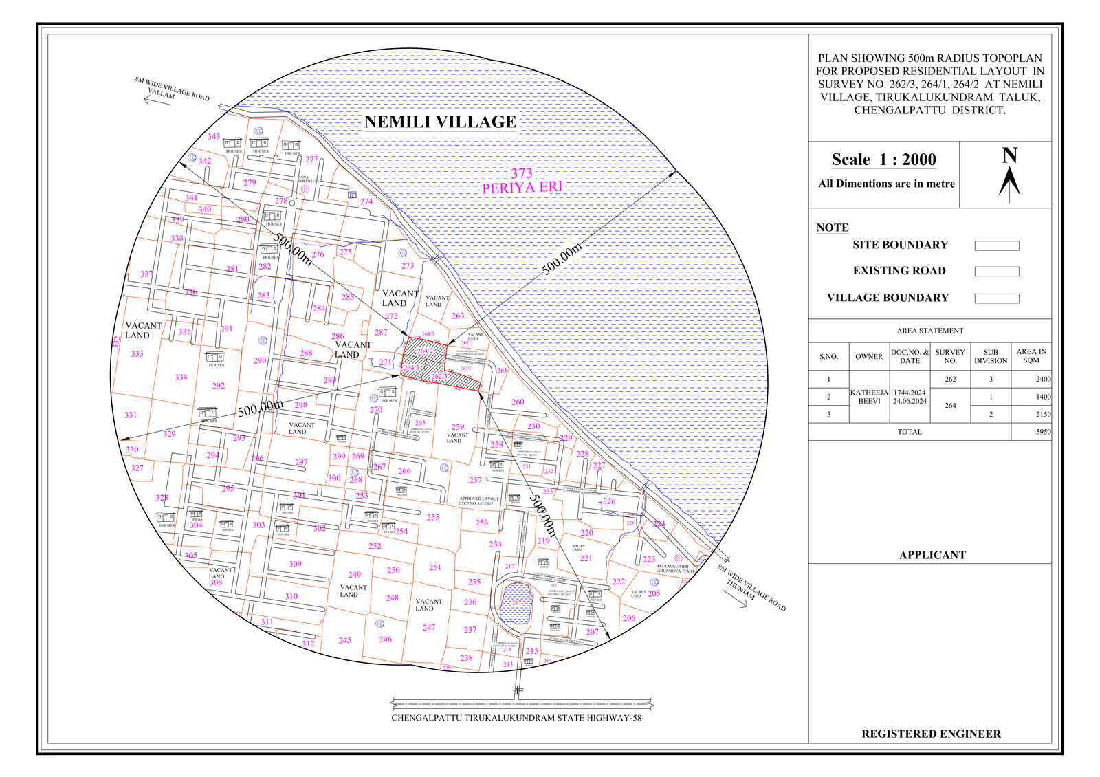
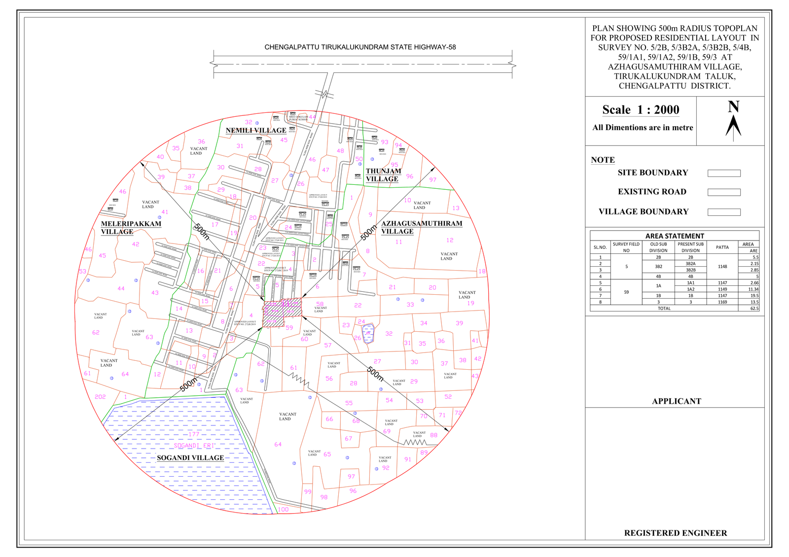
500m TOPO PLAN for proposed industrial & residential layout as per
TNCDBR 2019 planning permit norms.
Location: Chengalpattu
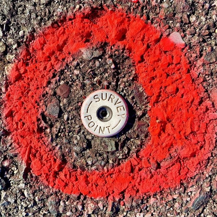
Boundary surveys are required when your property limits must be fixed with certainty, especially during real estate transactions, land sub-divisions, or neighbour-related disputes. At VALASEI, boundary determination is carried out as a cadastral survey, following officially recognised survey practices.
The process begins with research and investigation, reviewing Field Measurement Books (FMB), Patta, A-Register, Sale Deeds, and related government records. Your boundary is fixed using a 100% surety method, referencing existing village boundary stones, which serve as the primary control for land ownership.
A field survey using GNSS and/or Total Station is then conducted to correlate ground measurements with cadastral records. Observations are reconciled through comparison and best-fit adjustment, after which permanent boundary markers are placed at your property corners, supported by clear boundary documentation.
VALASEI's survey methodology is executed in accordance with government survey procedures, enabling the results to be directly recognised and recorded by licensed government surveyors. By the end of the process, your property is clearly fixed, cadastral-correct, and geofenced, ensuring that your boundaries cannot be misinterpreted or misused.
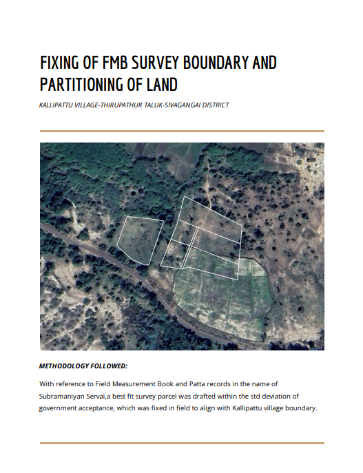
Identification of ownership using permanent survey monuments across
village boundary- Kallipattu, Sivagangai
Click the Image to download the Survey Report
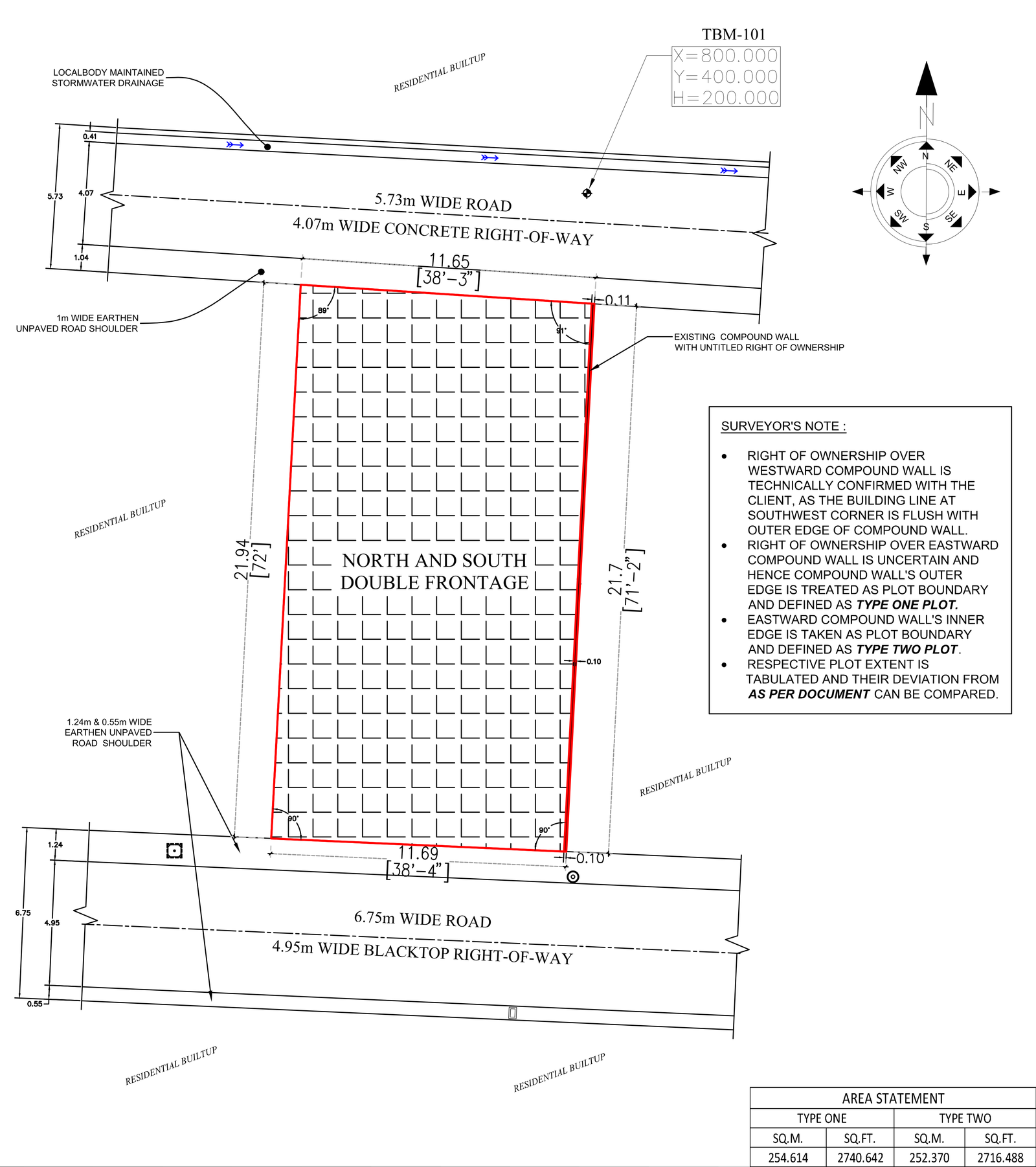
Consultation for boundary ownership over existing compound wall- Madambakkam,Chennai
Plan your site parcel into a residential, commercial, or industrial layout.
VALASEI converts your raw land parcel into a regulation-compliant development layout, focusing on subdivision, infrastructure placement, and approval readiness rather than individual building design.
Layout parameters are fixed in accordance with the Tamil Nadu Combined Development and Building Rules, 2019. Criteria such as the minimum width of the access road abutting the site, internal road and street widths, junction splay, open space reservation, and provisions for stormwater drainage, sewage treatment plants, and rainwater harvesting structures are established within the statutory framework using AutoCAD Civil 3D as the planning platform.
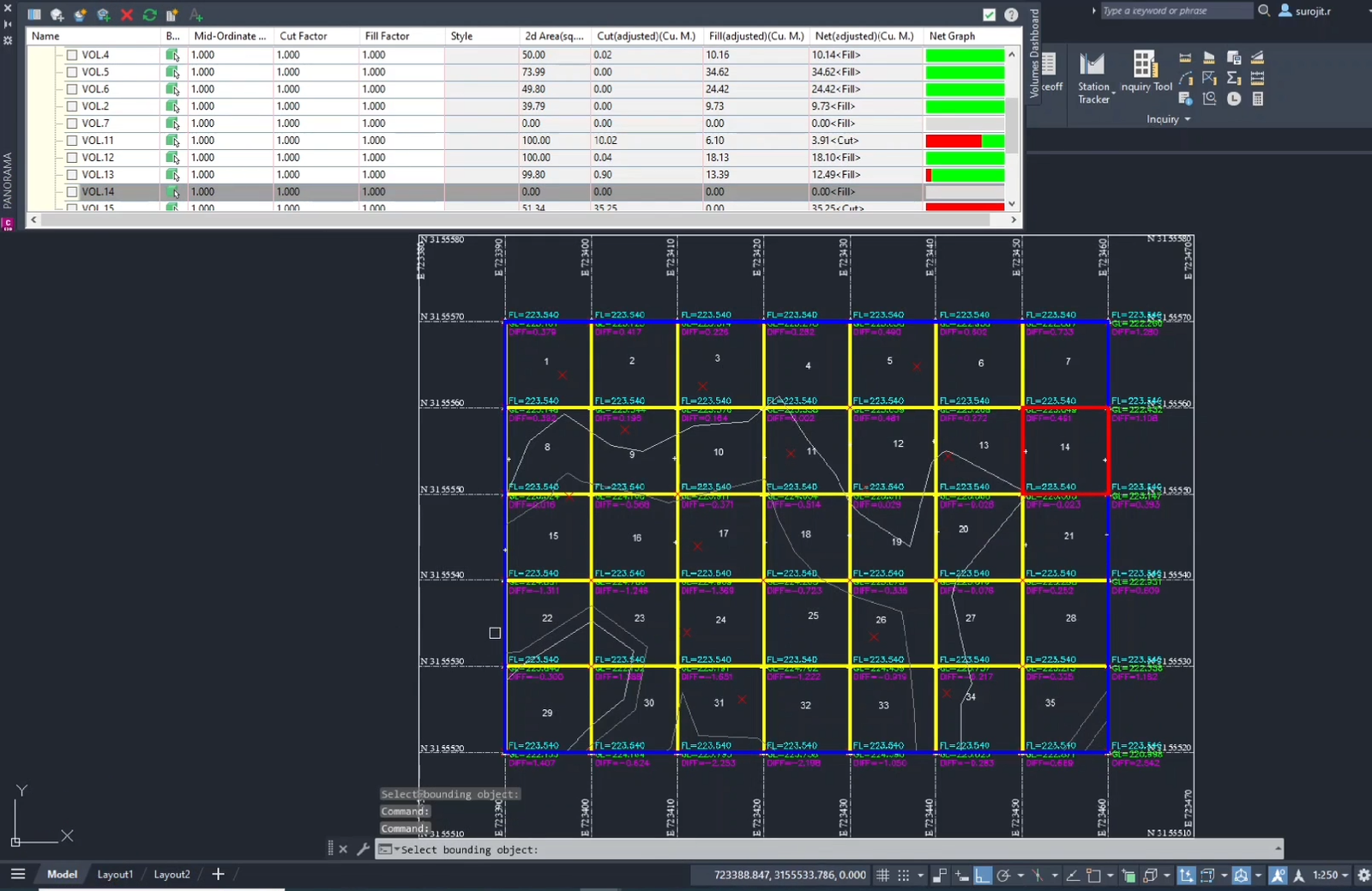
Once the layout is defined, the formed grade level is fixed by relating existing site elevations, the approach road level, and the seasonal high-water level of the receiving water body. Basing this level, CUT-AND-FILL quantities are calculated grid-wise, and longitudinal and cross-sections are prepared to clearly show level changes across proposed roads and plots.
Your land parcel is thereby organised into plottable area, road area, electrical and public utility area, and open space reservation area, in line with the norms prescribed under the Tamil Nadu Combined Development and Building Rules.
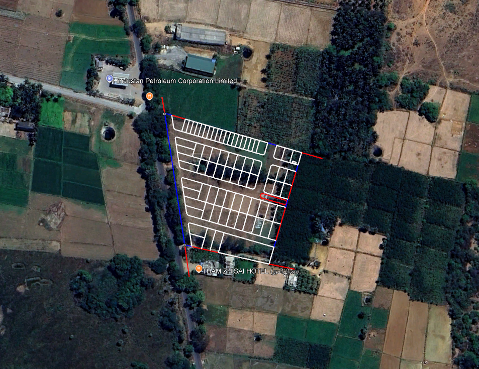
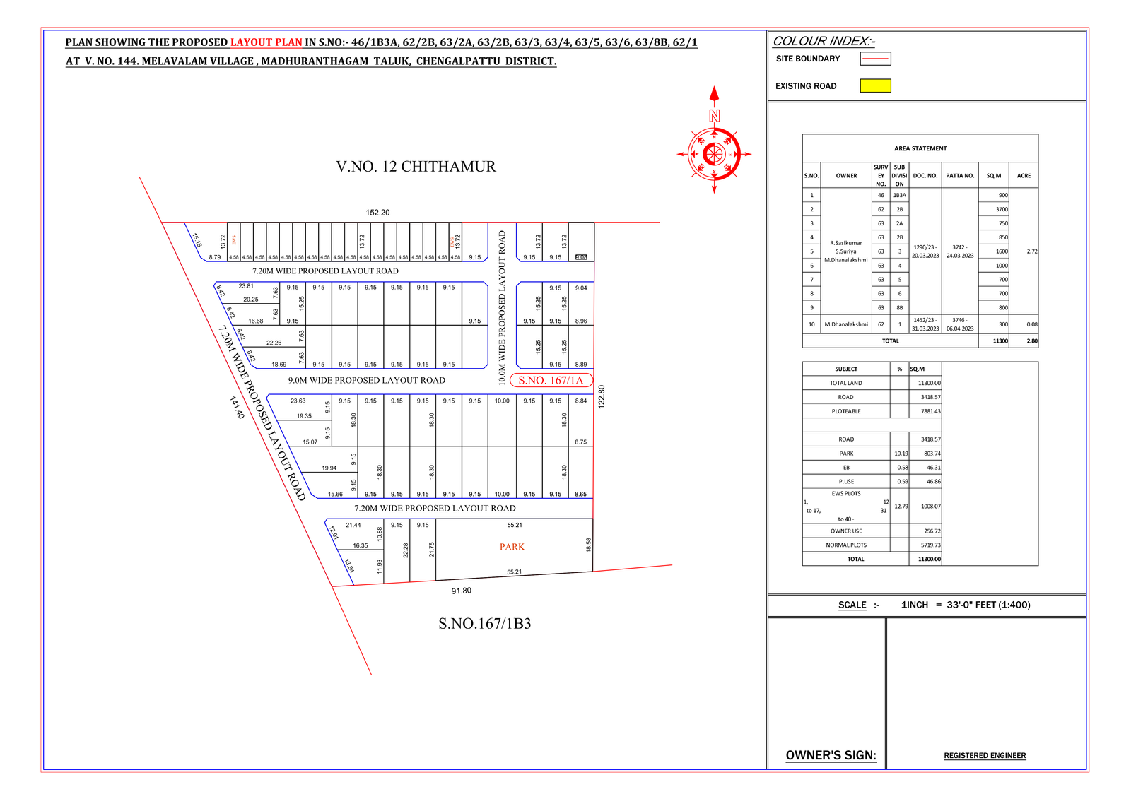
Site Assessment for Residential layout -Melavalam, Maduranthagam
Residential Layout planning for DTCP Planning Permit
Earthwork volumes define how a site transitions from its existing terrain to a buildable formation. Before excavation begins, it is essential to understand where material will be cut, where it will be filled, and whether the site balances or requires import or disposal. Accurate cut-and-fill analysis reduces cost uncertainty, avoids over-excavation, and ensures that grading decisions are made with full visibility of their construction impact.
VALASEI captures surface data using GNSS/DGPS, total station surveys, and drone-based photogrammetry, depending on site extent and accuracy requirements. GNSS and total station data are processed in AutoCAD Civil 3D, while drone imagery is processed through Agisoft Metashape to generate high-resolution surface models. The existing ground surface is then compared against the proposed formation level surface, allowing volumes to be computed surface-to-surface or grid-wise. This approach provides reliable earthwork quantities and supports clear visualisation of level transitions across the site.
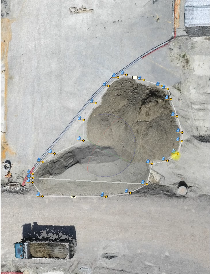
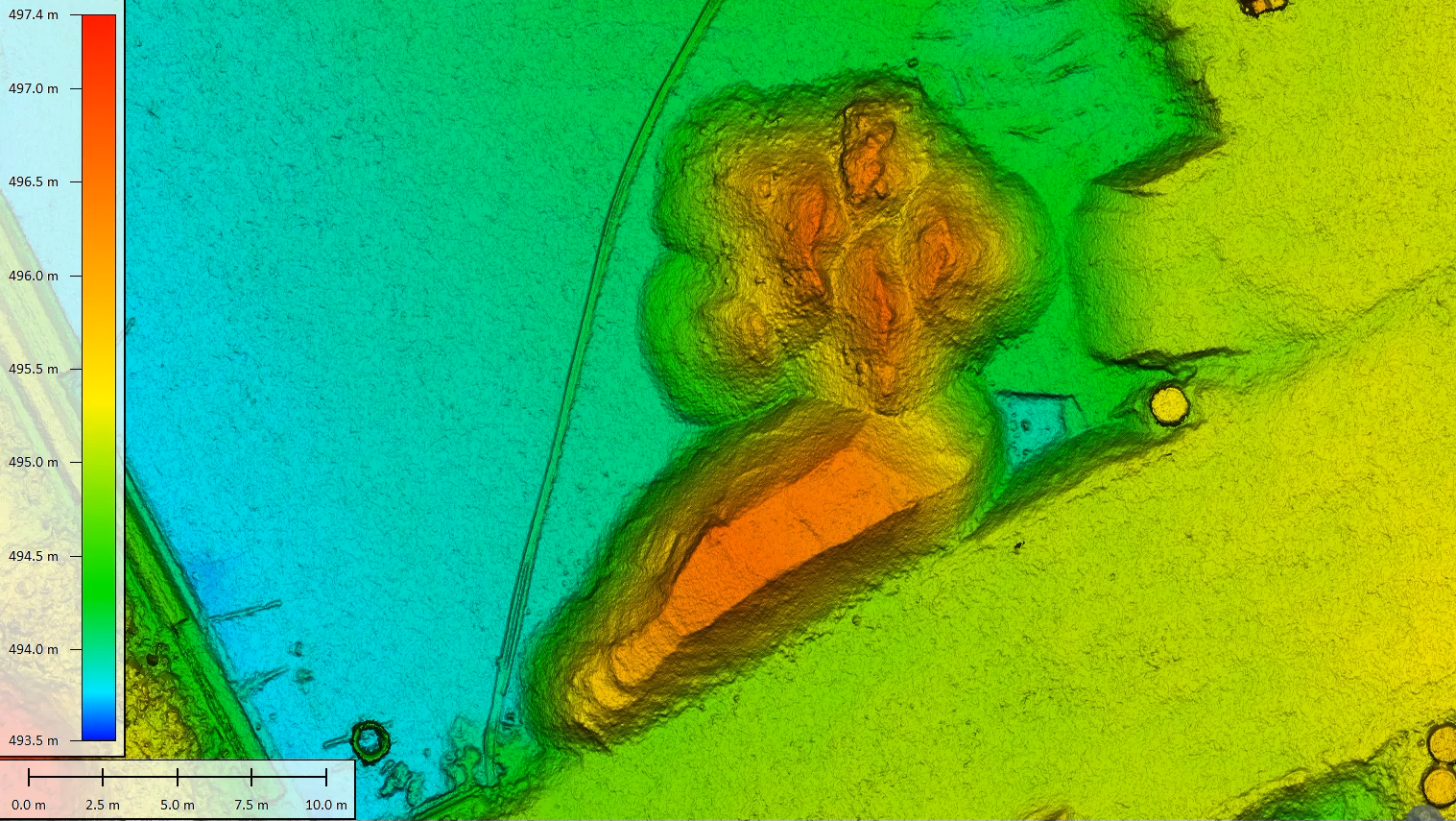
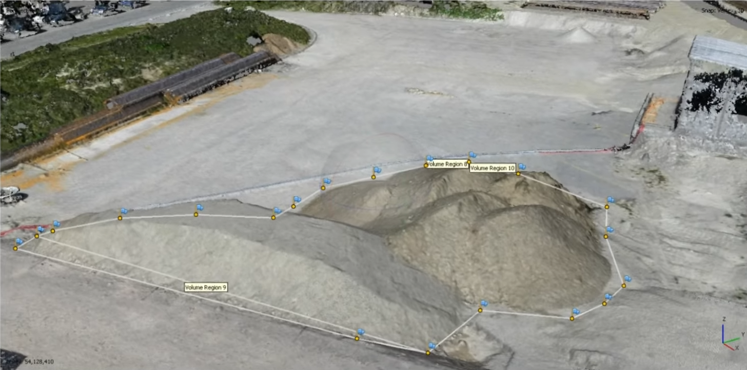
Volumetric analysis of water-washed M-sand at a crusher in Krishnagiri, TamilNadu
Site control establishes a permanent, high-precision reference framework across a project site, from which all distances, elevations, and alignments are measured. It forms the fixed geometric base that allows designs to be accurately transferred from drawings and models onto the ground and referenced consistently throughout construction.
At VALASEI, site control is established using Total Station observations to achieve millimetre-level accuracy. A network of permanent benchmark structures is created and connected through a closed-loop traverse, ensuring internal consistency and error control. The observed network is processed using least-squares adjustment in platforms such as STAR*NET and Leica Infinity to derive the most reliable control geometry. The control is then geo-referenced using GNSS Precise Point Positioning (PPP) through static observations, anchoring the site framework to real-world coordinates.
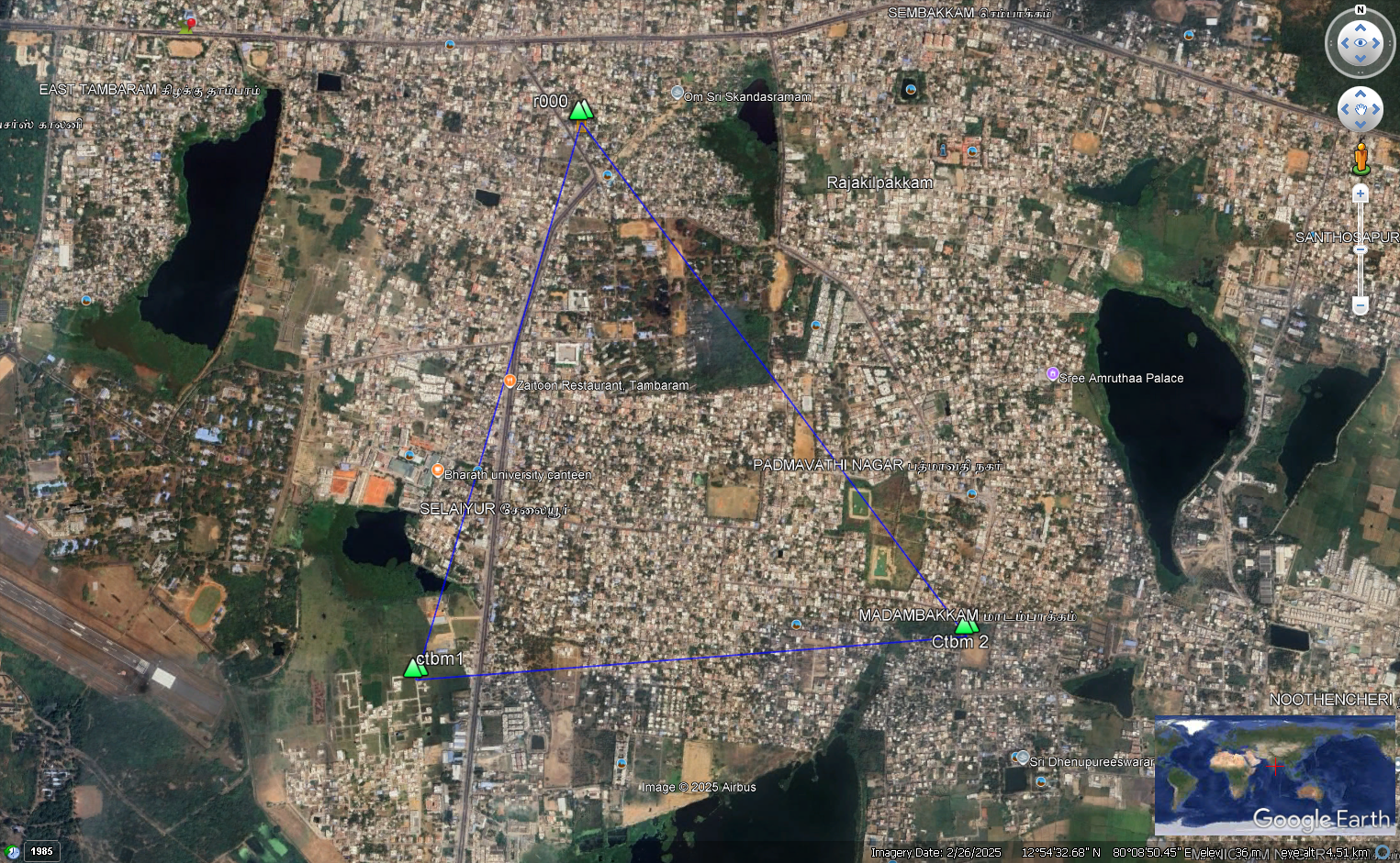
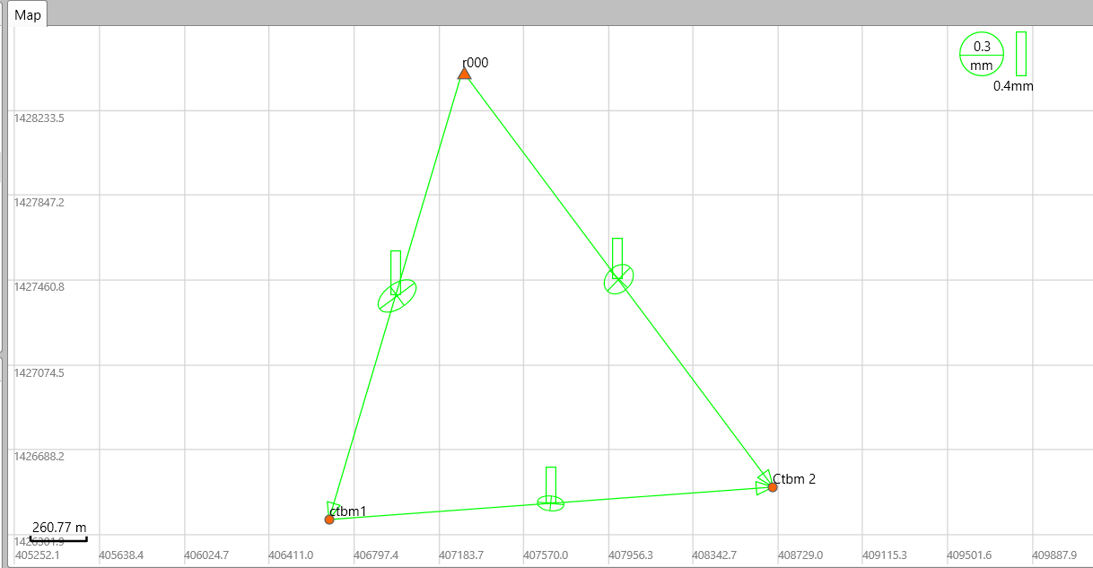
Establishment of permanent benchmarks as per SoI norms for GNSS accuracy comparison between brands
Discuss your requirements with our land development specialists
Connect With Us