Create reliable representations of the physical world by observing, measuring, and recording ground features with precision and accuracy.
Translate measured reality into organised plans and evaluations that support informed decision-making and responsible development, reflect ground truth.
Integrate surveying, GIS, and analytical methods to produce structured spatial information that connects field observations with broader geographic context.
VALASEI is a survey, planning, and geomatics firm working at the confluence of state-of-the-art technologies, including GNSS, photogrammetry, LiDAR scanning, UAV mapping, GIS, and geospatial analysis. We offer solutions and services across domains such as metrology, land development, infrastructure planning, heritage documentation, earth observation, and spatial decision support.
Founded by professionals with backgrounds in Civil engineering and Geoinformatics, trained at institutions such as Anna University and the University of Madras, VALASEI was incorporated to translate advanced measurement methods and spatial technologies into practical, field-deployable solutions. We have successfully executed projects for the public and industry by integrating scientific rigour with mindful application, combining art with science, and creativity with technology.
We deliver integrated surveying, planning, and geomatics services that take a site, structure or system from existing ground conditions through analysis, design, and documentation, enabling complete land development and reality-capture workflows from first measurement to final records.
Where every project begins
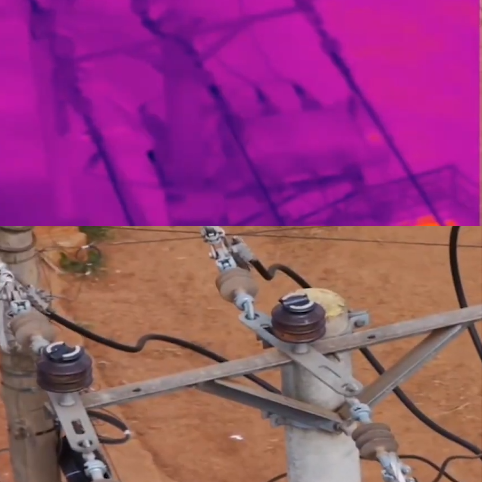
Total Station | GNSS / DGPS | Drone Surveys | Ground Penetrating Radar | Feature Mapping | Control Establishment |
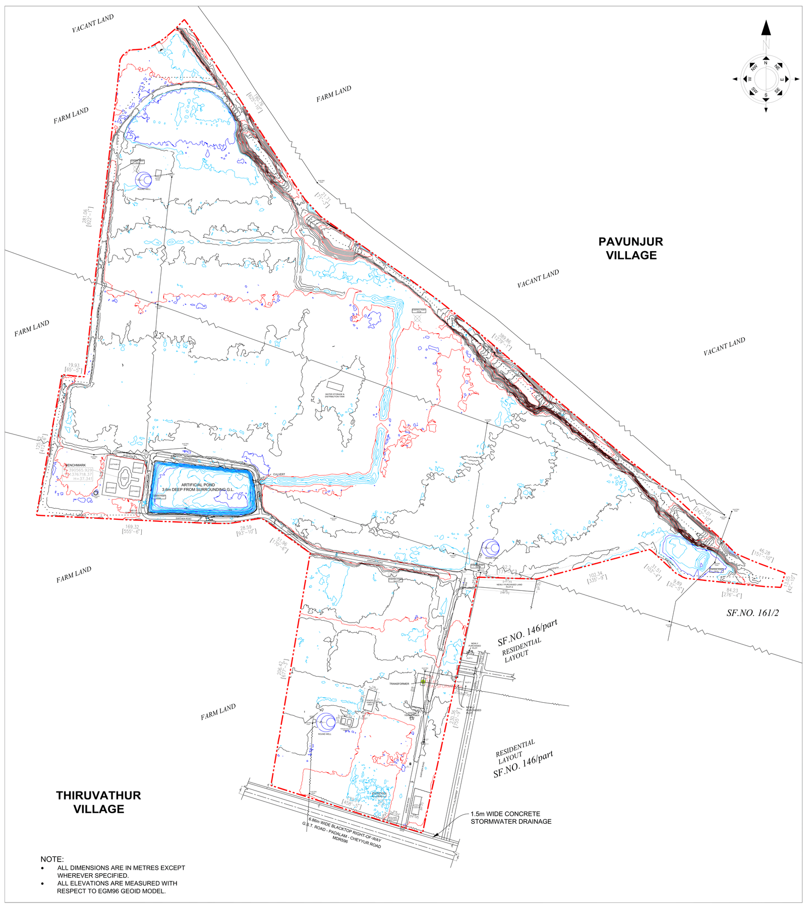
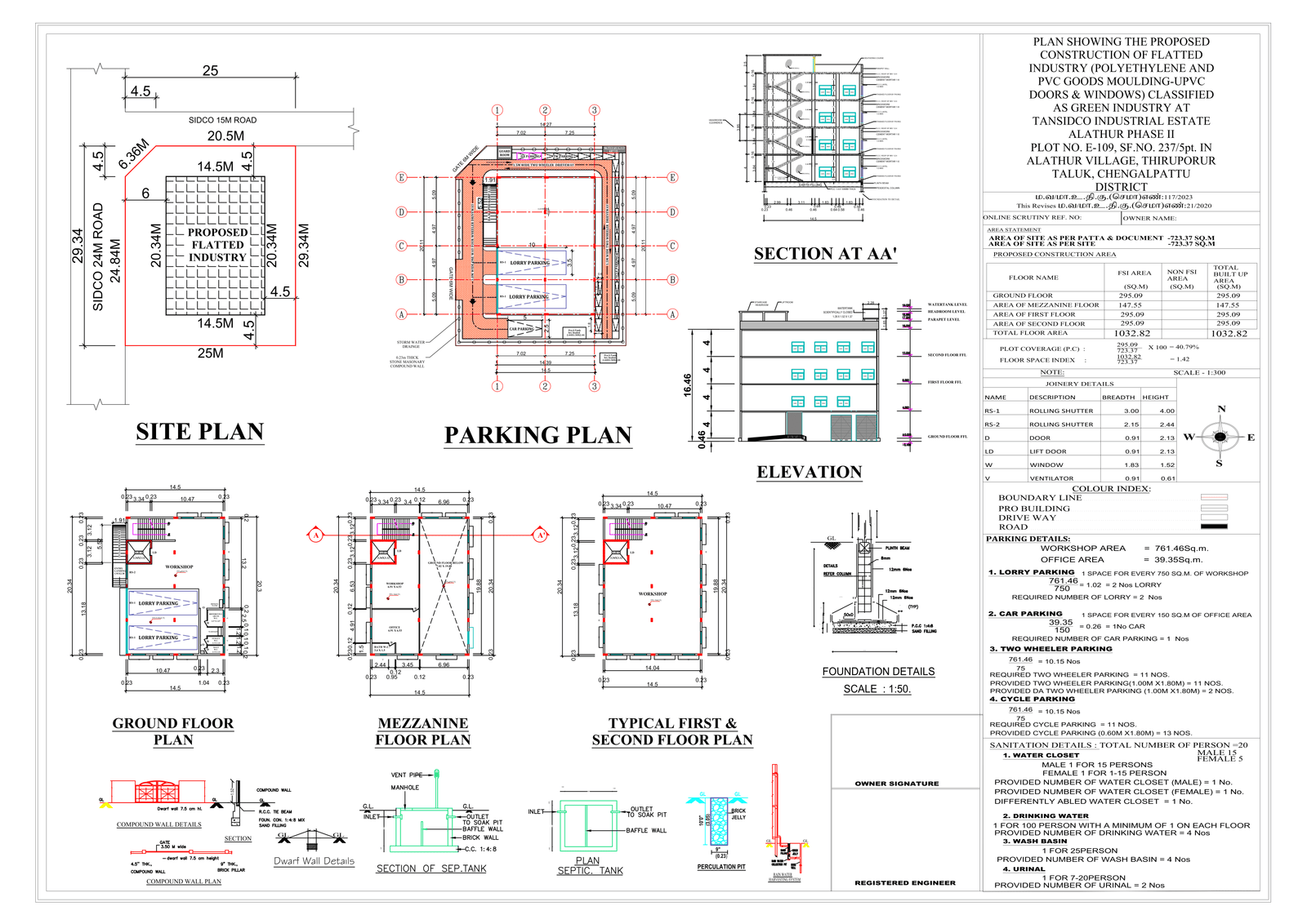
Turning measured reality into buildable decisions
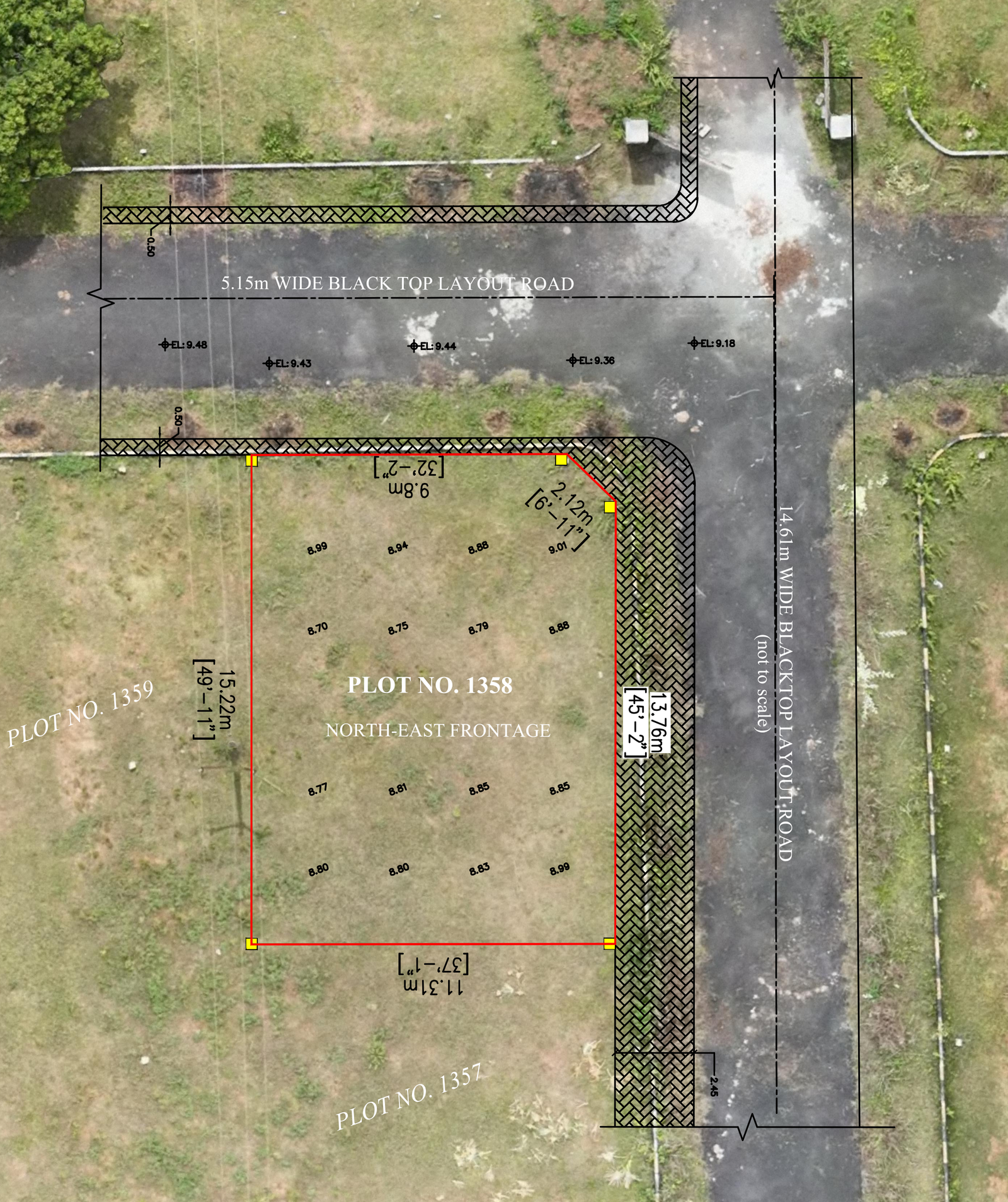
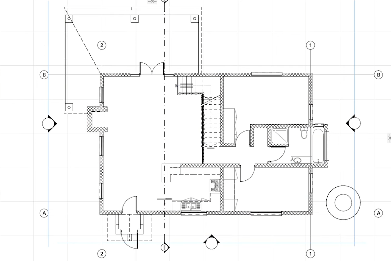
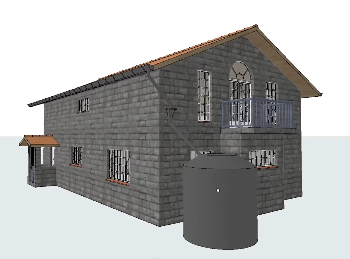
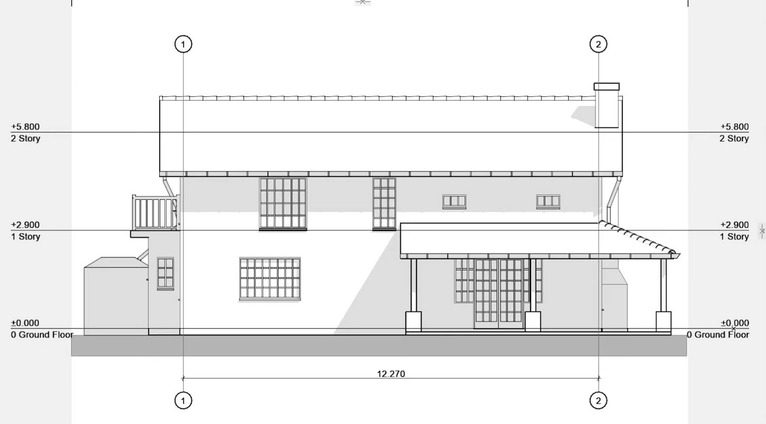
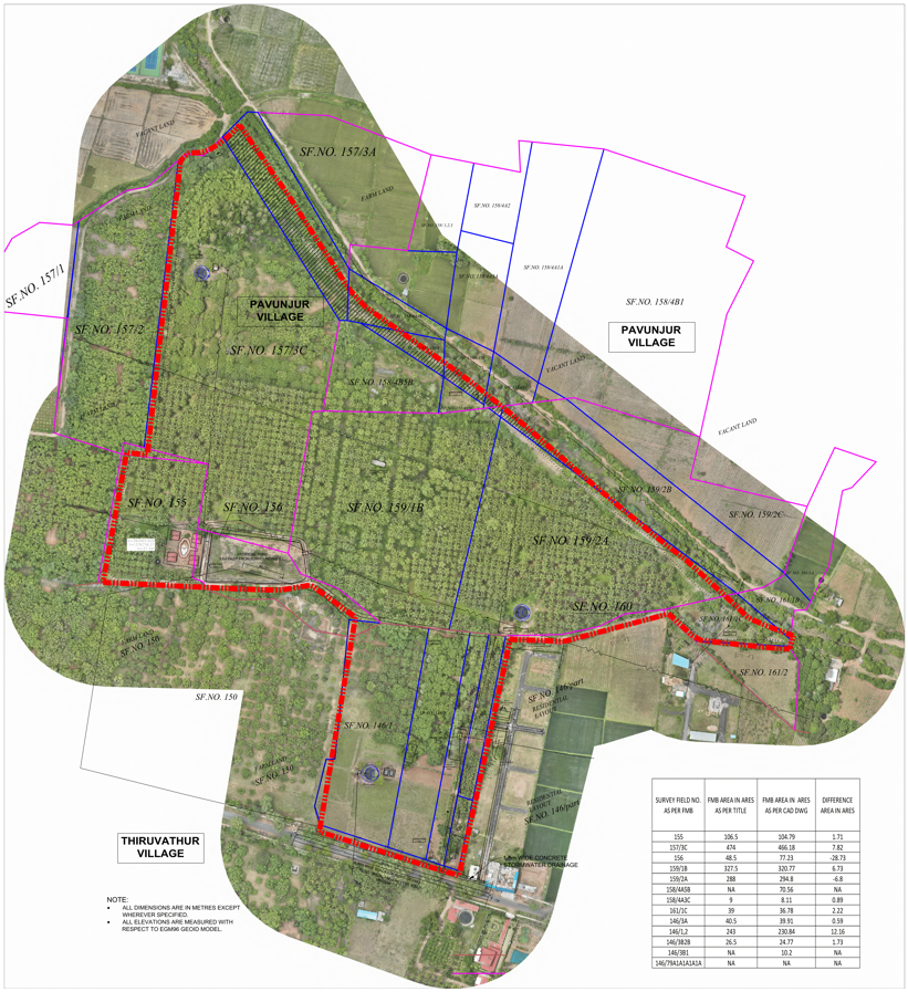
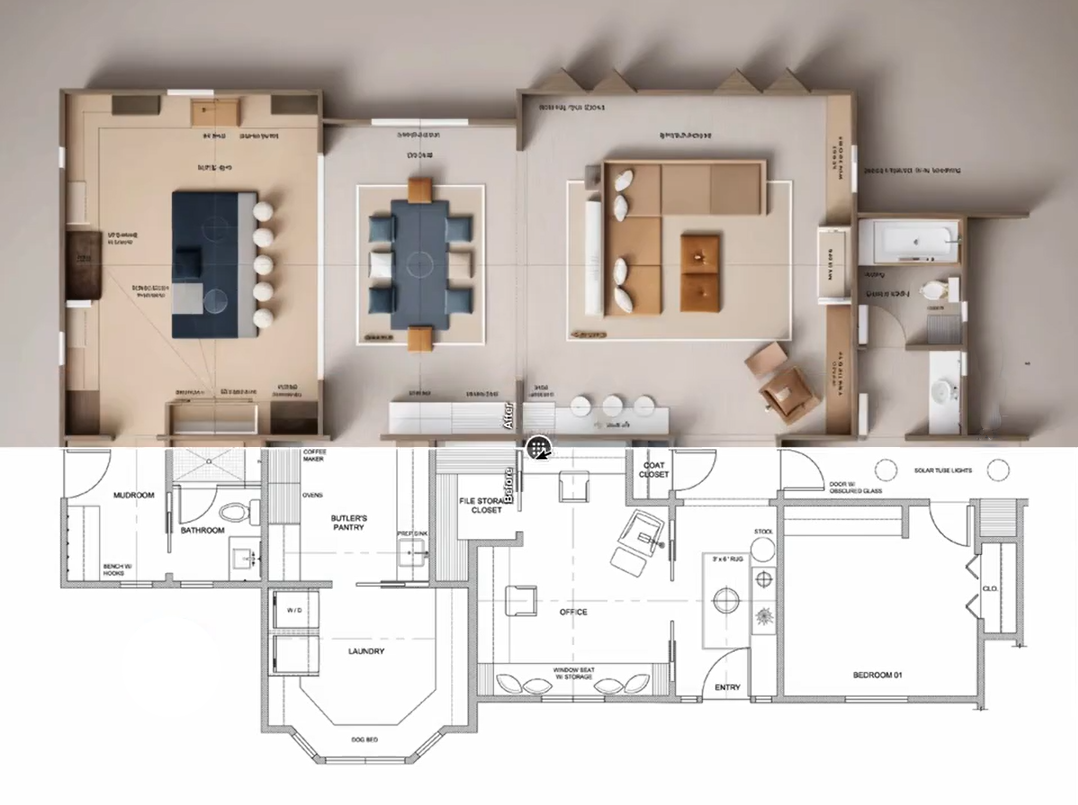
Site & Building Planning | Cut & Fill Analysis | Profiles & Sections | GIS Analysis | Development Support |
Recording what exists — accurately and defensibly
Heritage Documentation | Dilapidation Surveys | Corridor Mapping | Environmental Mapping | Archival Records |
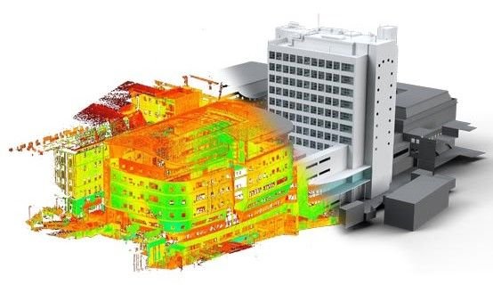
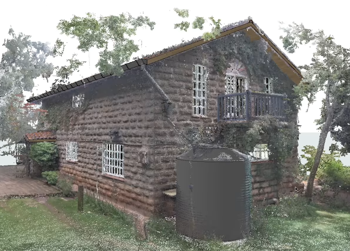
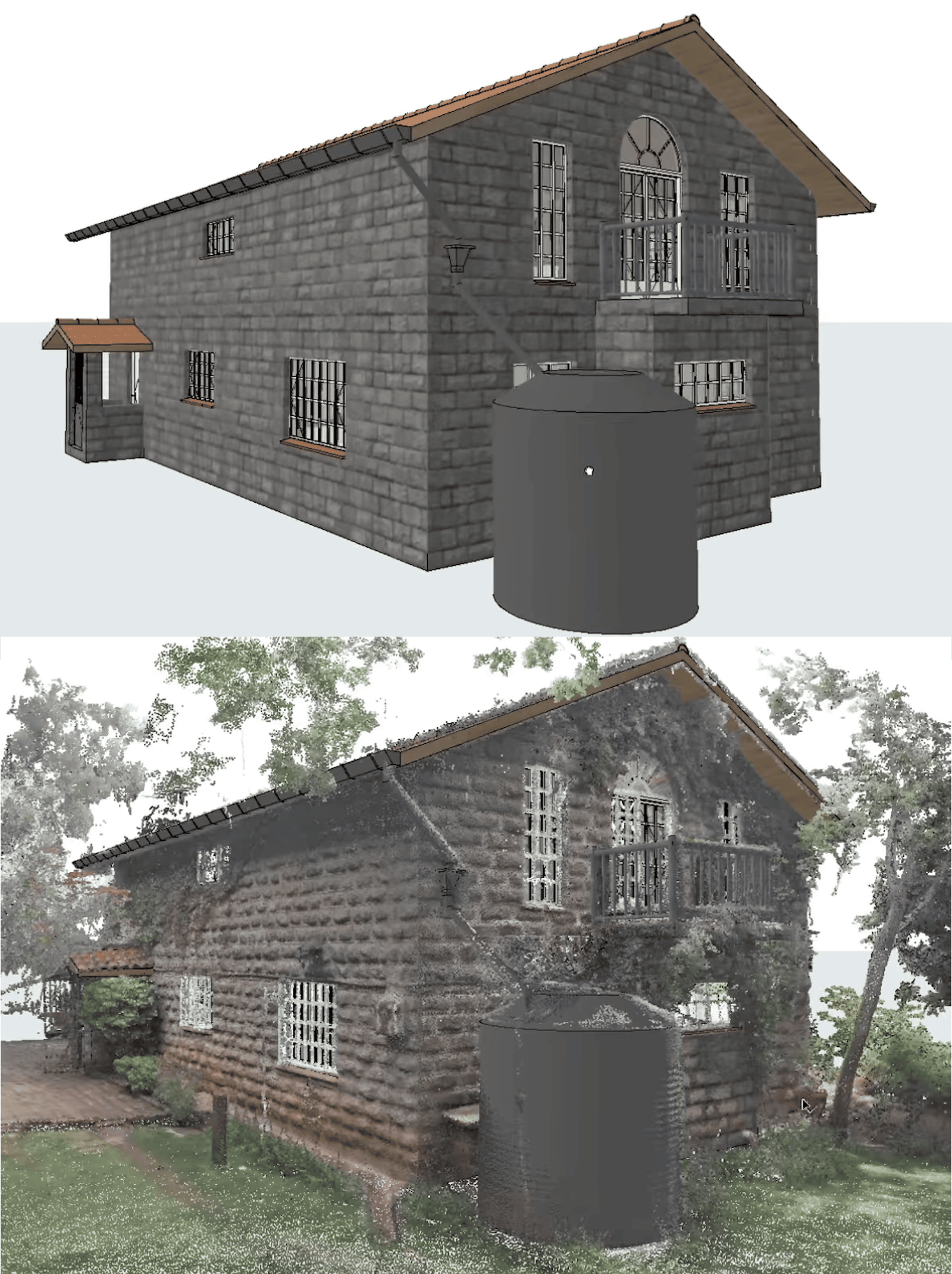
From physical form to digital truth
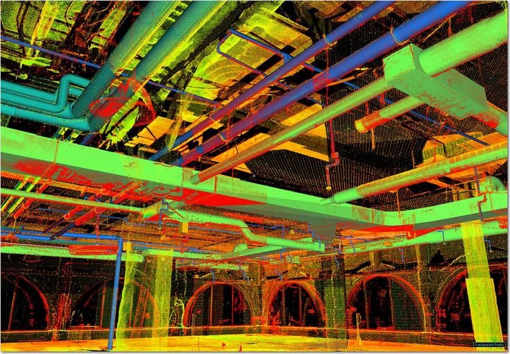
Photogrammetry | Laser Scanning | Point Clouds | 3D Meshes | BIM Modelling |
Our services are applied across multiple industry sectors where accurate measurement, spatial understanding and dependable documentation are essential. The following applications reflect how our work supports land development, architecture, construction and related built-environment contexts.
Get in touch with our team for a consultation and quote
Connect With Us